Benefits of membership
Members of our clubs through affilation with 4WD NSW and ACT Inc enjoy many benefits, discounts and opportunities. Find out more HERE
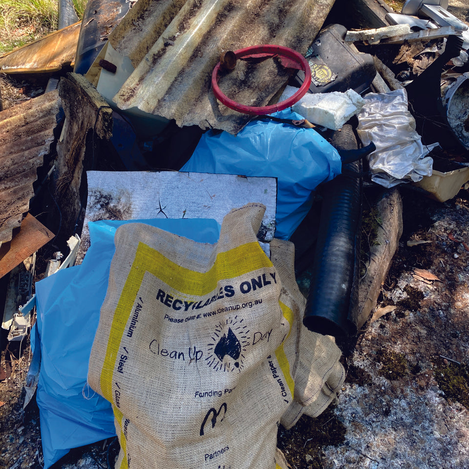
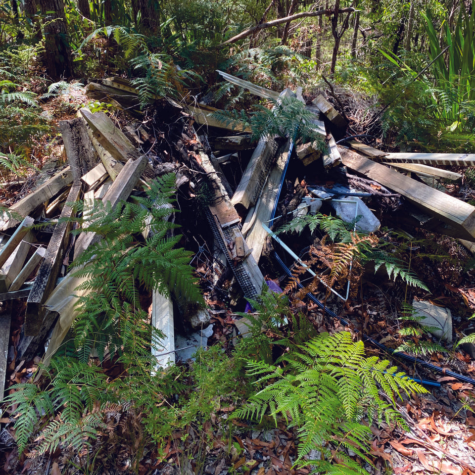
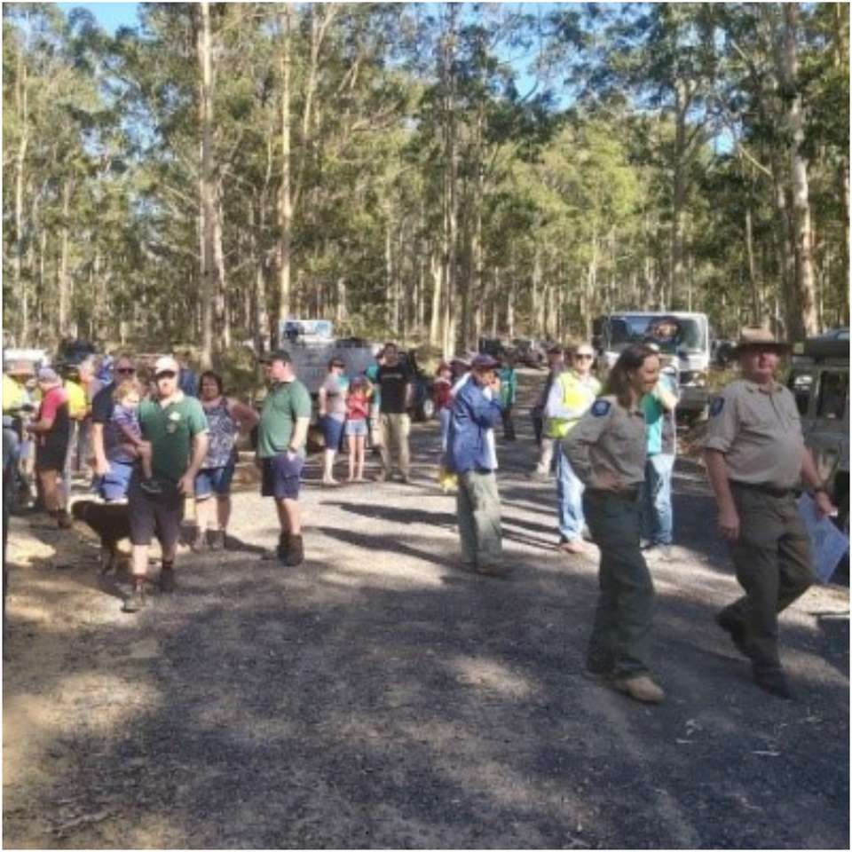
Hunter 2024 - Clean up Australia

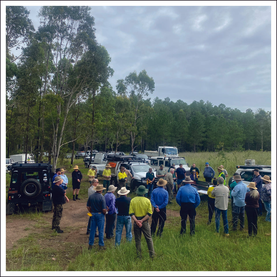
Forest Corp, NPWS, clubs and Council working together.
We identified the area in need of a clean up (the site of the former State Forest Depot) in Wallaroo State Forest which adjoins Wallaroo State Conservation area, this lead us to reach out to NPWS to see if they would like to participate and allow us to clean up a greater area. Through meetings between the Hunter Region 4WD Council and NPWS the invitation was taken up.

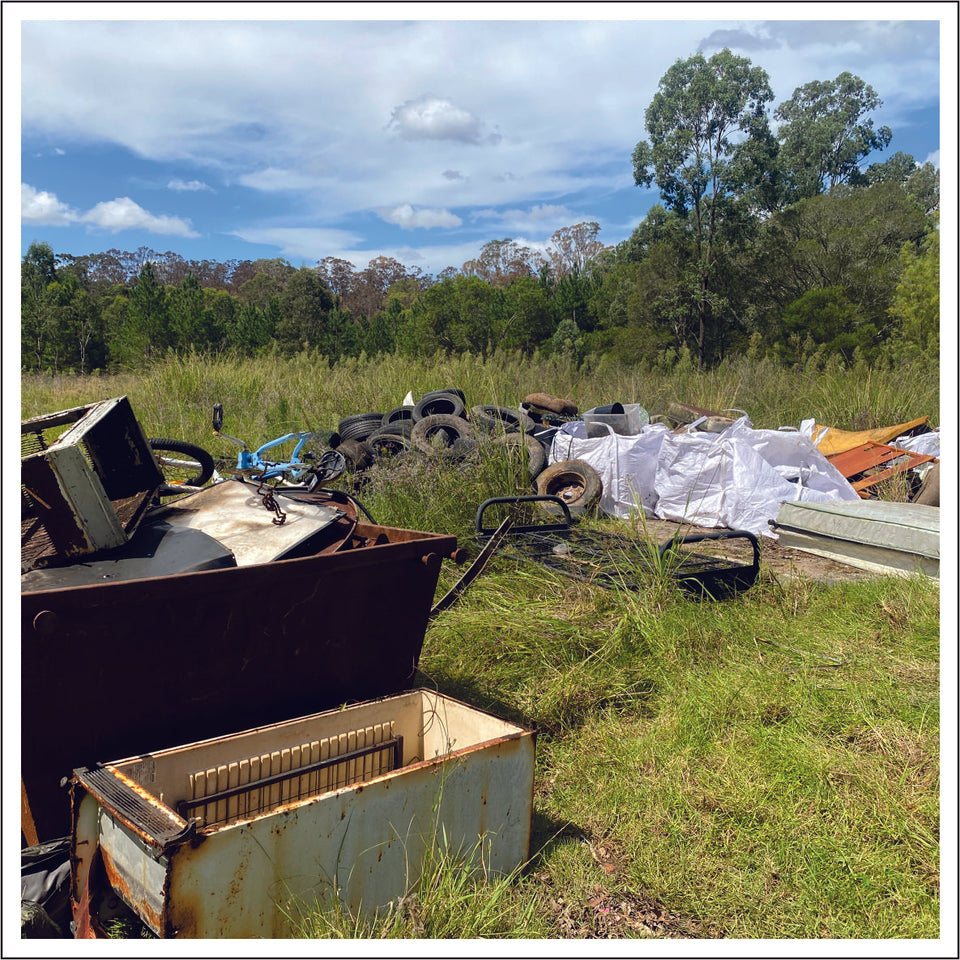
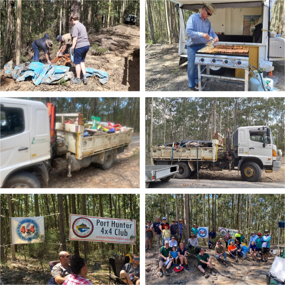
Tiles, building waste and many tyres are dumped each year.
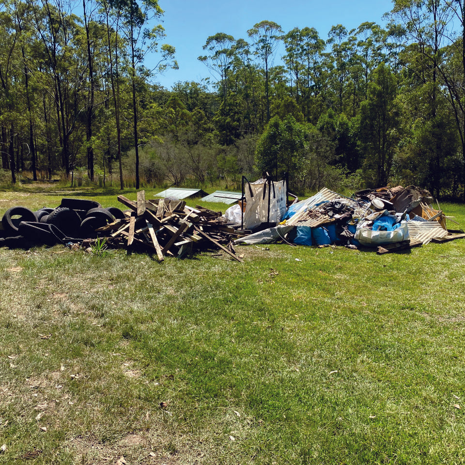
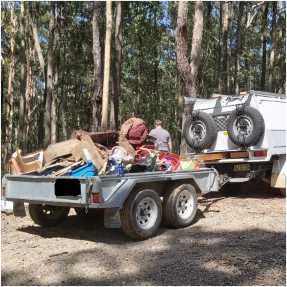
The troops were provided with maps and the location for 3 metal scrap bins, the vehicles, trailers and trucks were off and running. They come and went bringing the waste to the central general waste depot, this included tyres, lounges, metals, tiles etc. Smaller items were placed in bulka bags that could be lifted from the trailers by the trucks Hiab saving on double handling.

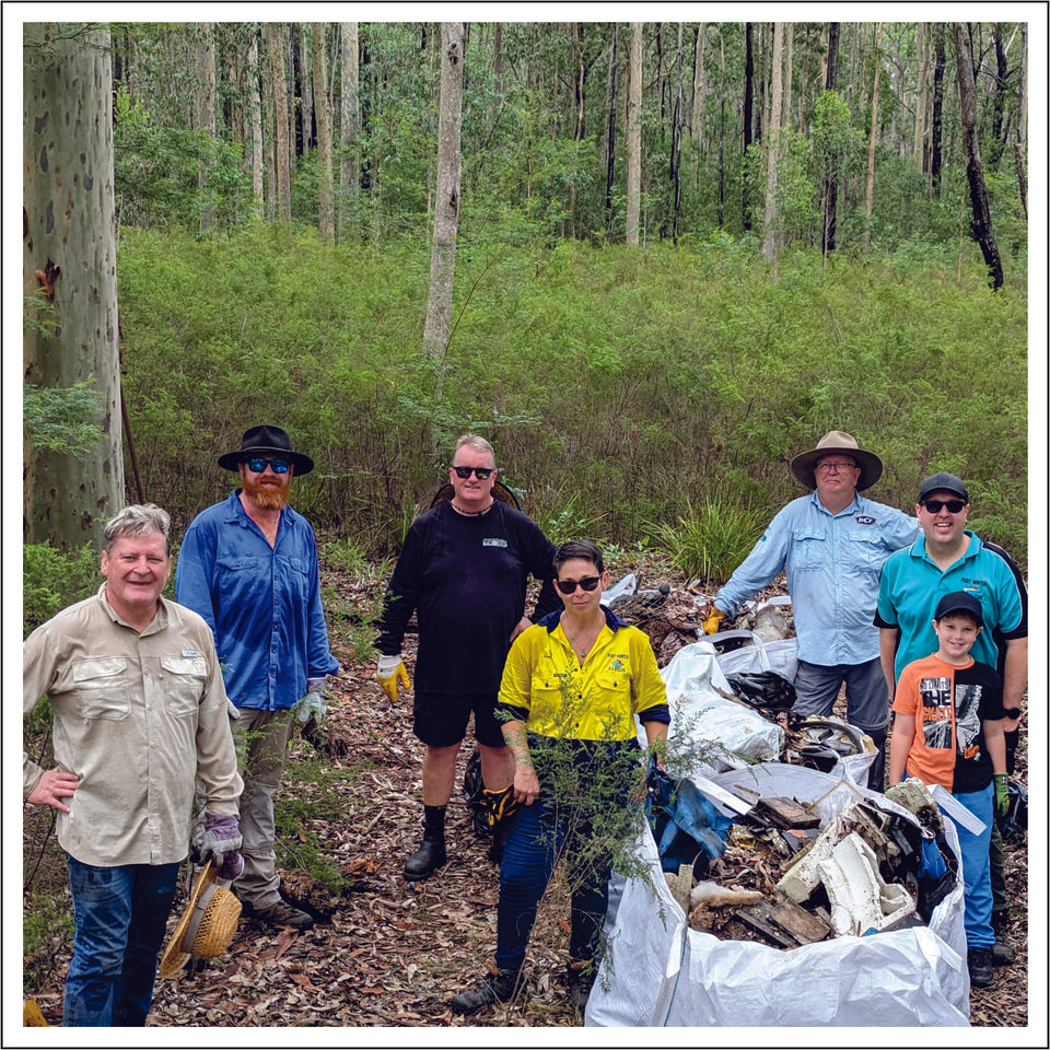
Tired and dirty by the end of the day, but satisfied with the result.
The waste continued to roll in until it was time to feed the troops the traditional sausage sizzle. This was provided by Forest Corp. The estimate of waste removed by volunteers is 6 tonne, about 70 tyres and 3 tonne of steel. From 2017 to 2023 we have collected 55.49 tonne and 607 tyres. Recovered car bodies and steel are not weighed as they are picked up directly by scrap dealers.
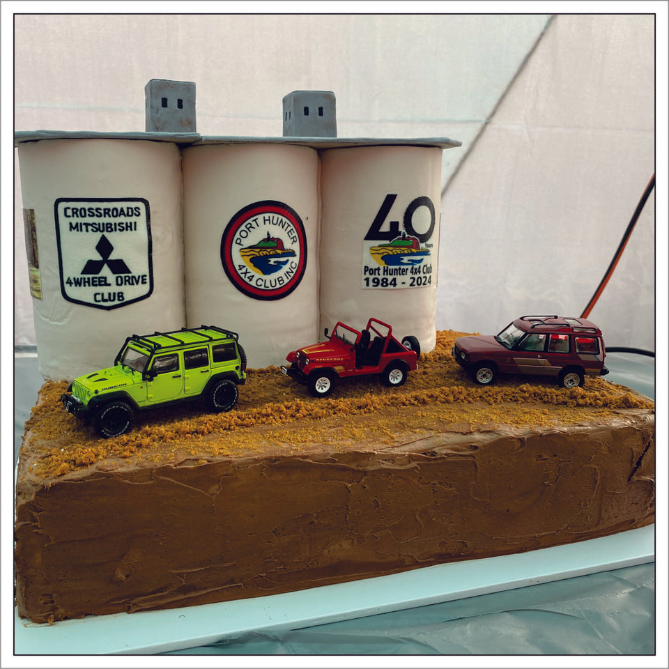
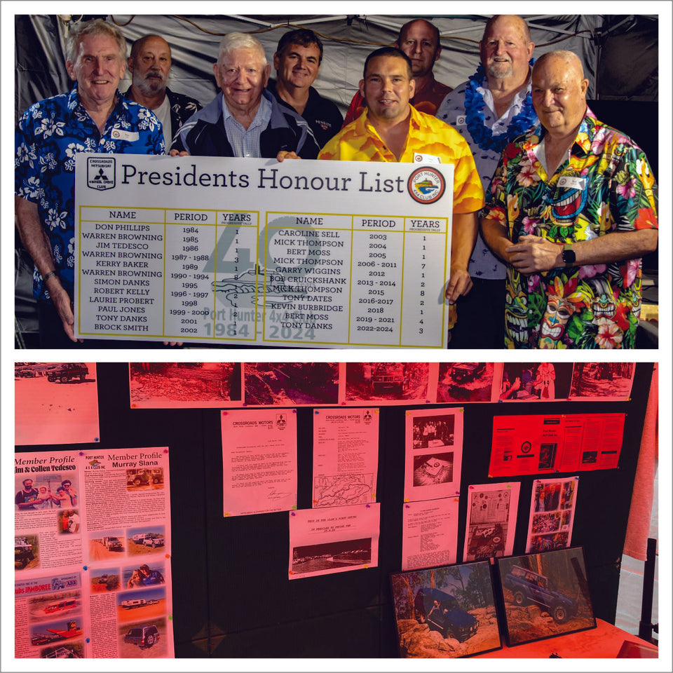
Port Hunter 4x4 Club celebrates 40 years

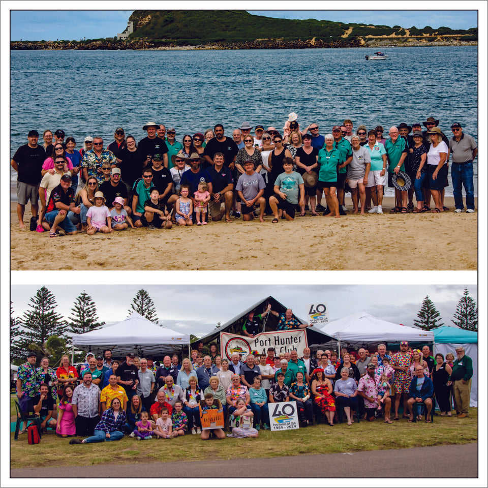
1984 - 2024
Port Hunter 4x4 club celebrated its 40th anniversary with the iconic Nobbys Lighthouse featured on its logo as the backdrop. Almost 100 members & guests attended a catered dinner, the highlight being a Silo Art inspired cake.

Community Values
Starting in 1984 as the Crossroads Mitsubishi & L300 4 Wheel Drive Club, the club has remained true to its original goals focusing on trips, friendships, driver education, and community service.

Looking forward to 50 years
The weekend was a highly social occasion with games, kids activities, catching up with former members & reliving past trips with an extensive display of club memorabilia. New plans for future trips were hatched!
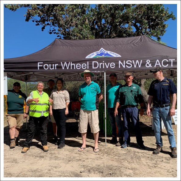
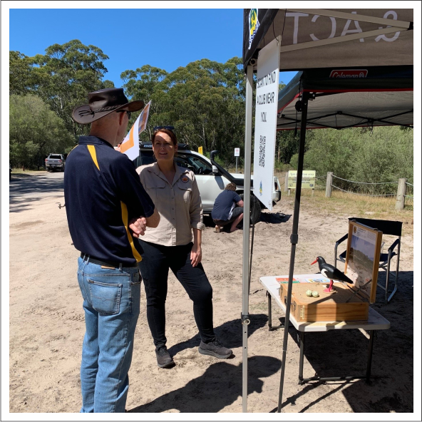
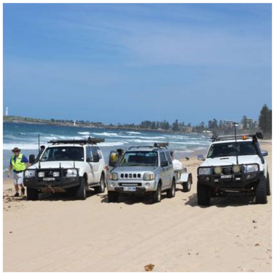
Lavis Lane Pop up Inflation Station

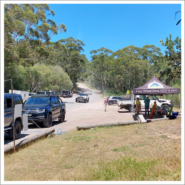
The approach to Stockton Beach
Lavis Lane, Worimi Conservation Lands (Stockton beach) was the site of our pop-up inflation station and information stand.
NPWS had Discovery Rangers setup and a marque alongside ours to educate the public on shore birds.
The aim of the day was to engage with the public and educate them on the benefits of being in an incorporated club. Also to help them understand correct tyre pressure for beach driving.

Sharing our knowledge and experience
For those new to beach driving, we offered some tips to help make their first time more enjoyable.
To engage with those that have experience or think they know, we had an inflation station setup, to make airing up easier.
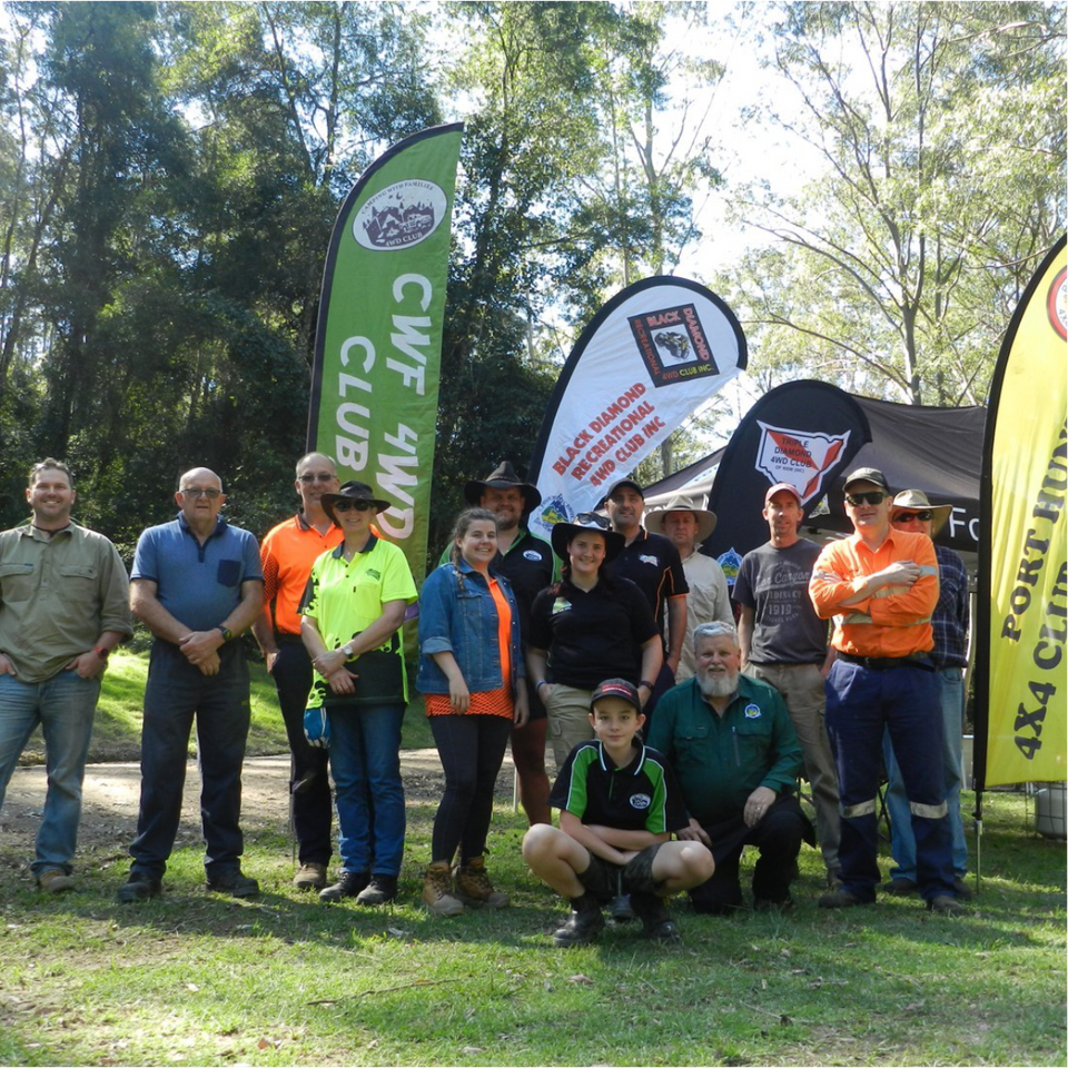
Members of four Hunter region clubs: Central Coast 4WD Club, Gold Eagle 4x4 Club, Newcastle & Districts
4WD Club, Port Hunter 4x4 Club volunteered on the stand.

Safety for people, cars & the birds.
The beach was busy and the Four Wheel Drivers that we engaged with, were evenly split between Newcastle & Sydney residents. The furthest coming from Orange.
The event was a huge success, with future events a very real possibility.
The concept had the full support NPWS & WCL board.
Coates Hire & Signwave Newcastle helped with compressor hire and signs.
Straps Up High Program

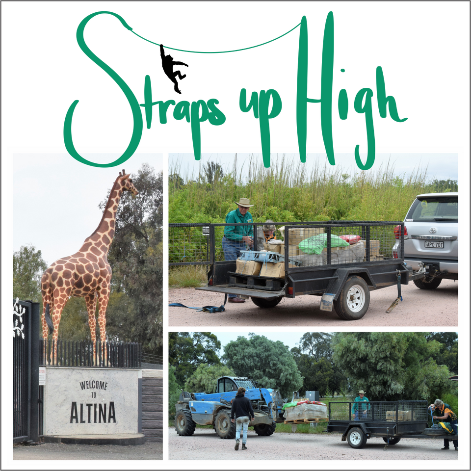
Making a difference
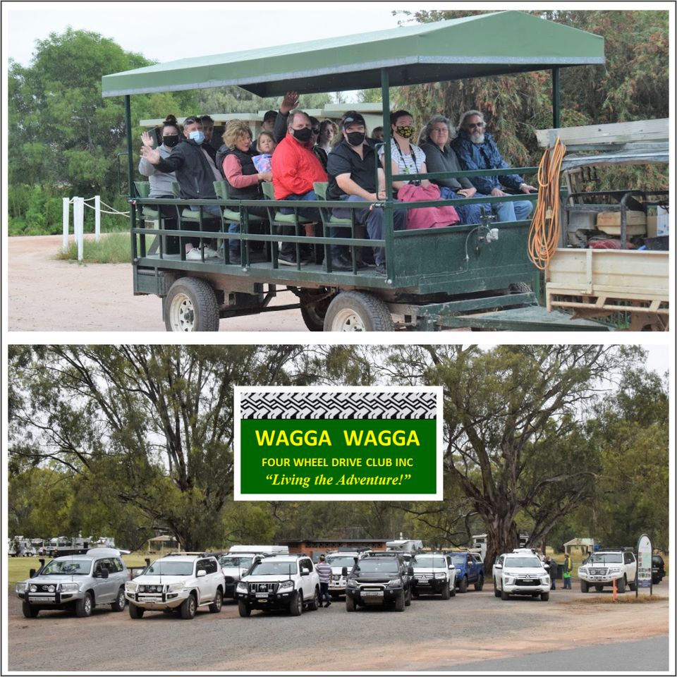
On 20 November, about 40 members of the Wagga Wagga Four Wheel Drive Club Inc visited Altina Wildlife Park at Darlington Point to present around 180 straps and slings to benefit the animals of the Park as part of the state-wide 4WD NSW and ACT Straps up High project.

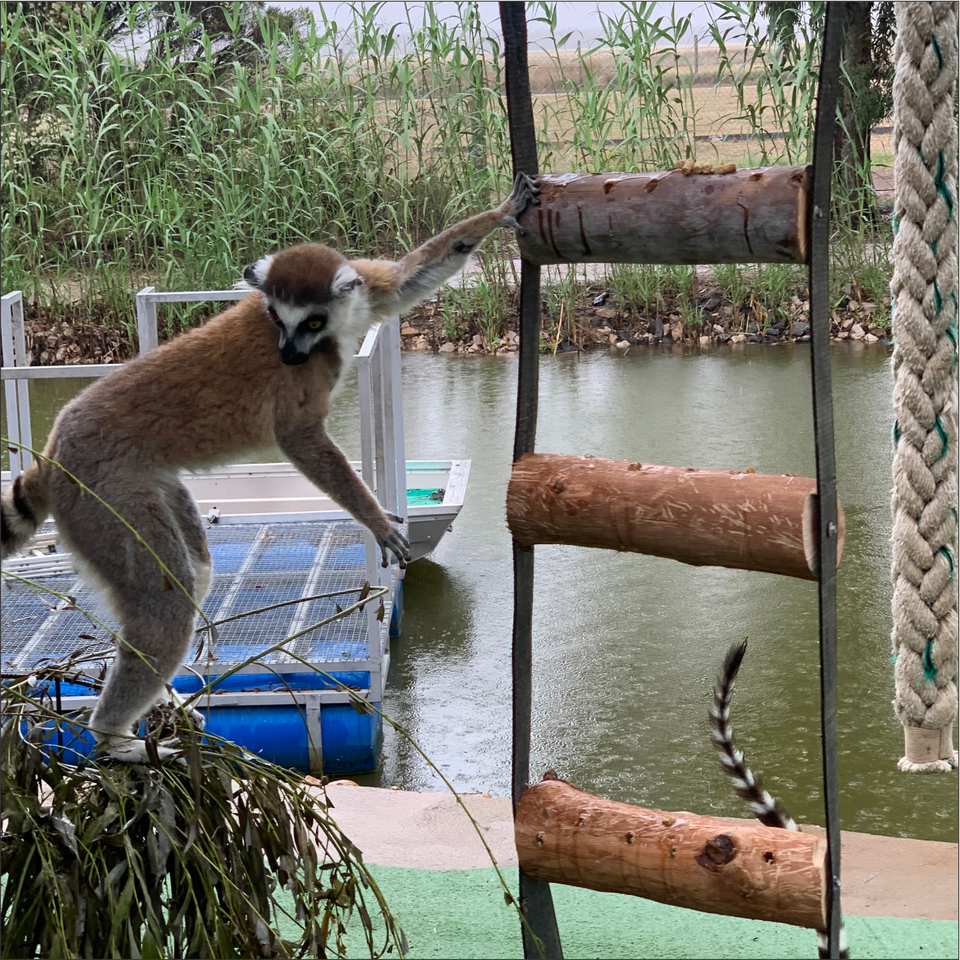
Happy animals
The straps and slings (weighing about 450kg) were obsolete ones kindly donated by Rodney's Transport Services, The Riverina Co-Operative Society Ltd and club members, with club members John and Brenda Moore co-ordinating the effort.

Helping because you can
Not only will these straps benefit the animals and the wildlife park, the environment will also benefit because the straps will not end up in landfill. A certificate, which is now on proud display in the Altina visitors centre, was presented to Altina to mark the occasion.
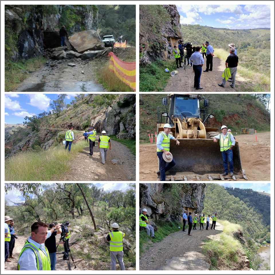
The Bridle Track re-linking Hill End with Bathurst

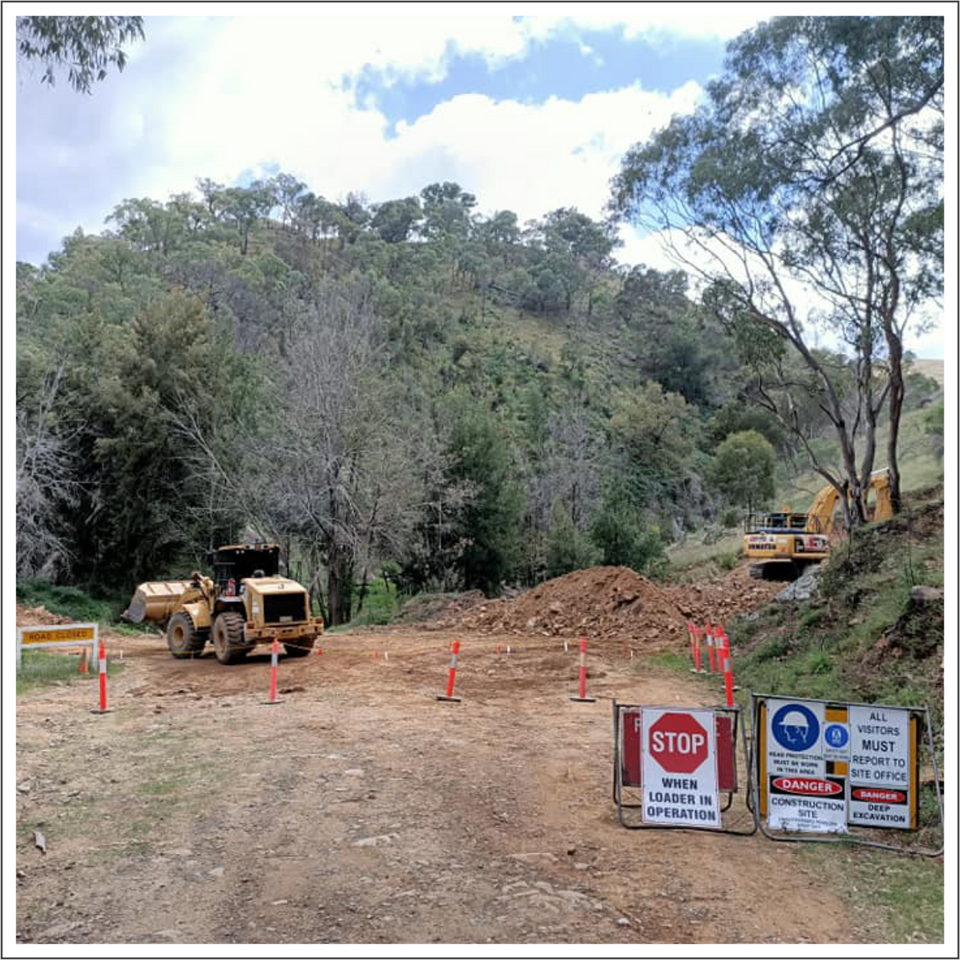
And so it begins....
In 2010 a rockfall at Monaghans Bluff cracked the road and made it impassable. The NSW government provided $2m to Bathurst Council to see the road reopened. Some land needed to be acquired to divert the track the 2km around Monaghan’s Bluff. This diversion will avoid future rockfalls and make the road safer.

A win for all users.
After so many years closed, there is much excitement generated by the work in progress and the anticipated reopening date. This is a huge win for residents, families, adventurers, anglers, campers, riders, and 4WD enthusiasts. This will grow tourism in the local area and provide a much needed economic boost for the region.

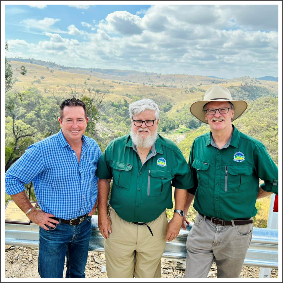
Bridle Track reopened 13.02.23
The Bridle Track has officially reopened today, finally re-linking Hill End with Bathurst. The official reopening on the track was attended by the Hon Paul Toole (State Member for Bathurst), with invited guests Craig Thomas (President) and Roger Pollett (Lands Projects) from 4WD NSW and ACT Inc.
Hunter 2023- Clean Up Australia

Many hands
- Members from Newcastle & Districts 4WD Club, Port Hunter 4x4 Club,
- Gold Eagle 4WD Club,
- Land Rover Owners Club of Sydney,
- and the Central Coast 4WD Club along with members of the public took part in the annual Clean Up Australia Day event.

Such a mess
Four Wheel Drivers set about
cleaning up local forests.
Every year our clubs work with Forestry Corp, Illegal Dumping Investigators & Lake Macquarie City Council Area Rangers to clean up the mess left by others.

Big results
This year’s result were;
- 7.4 tonnes of mixed waste removed.
- 141 tyres removed.
- Asbestos found not included in total.
- Vehicles not included in total.
- One matter investigated – no formal action.
Lost City - Graffiti Removal

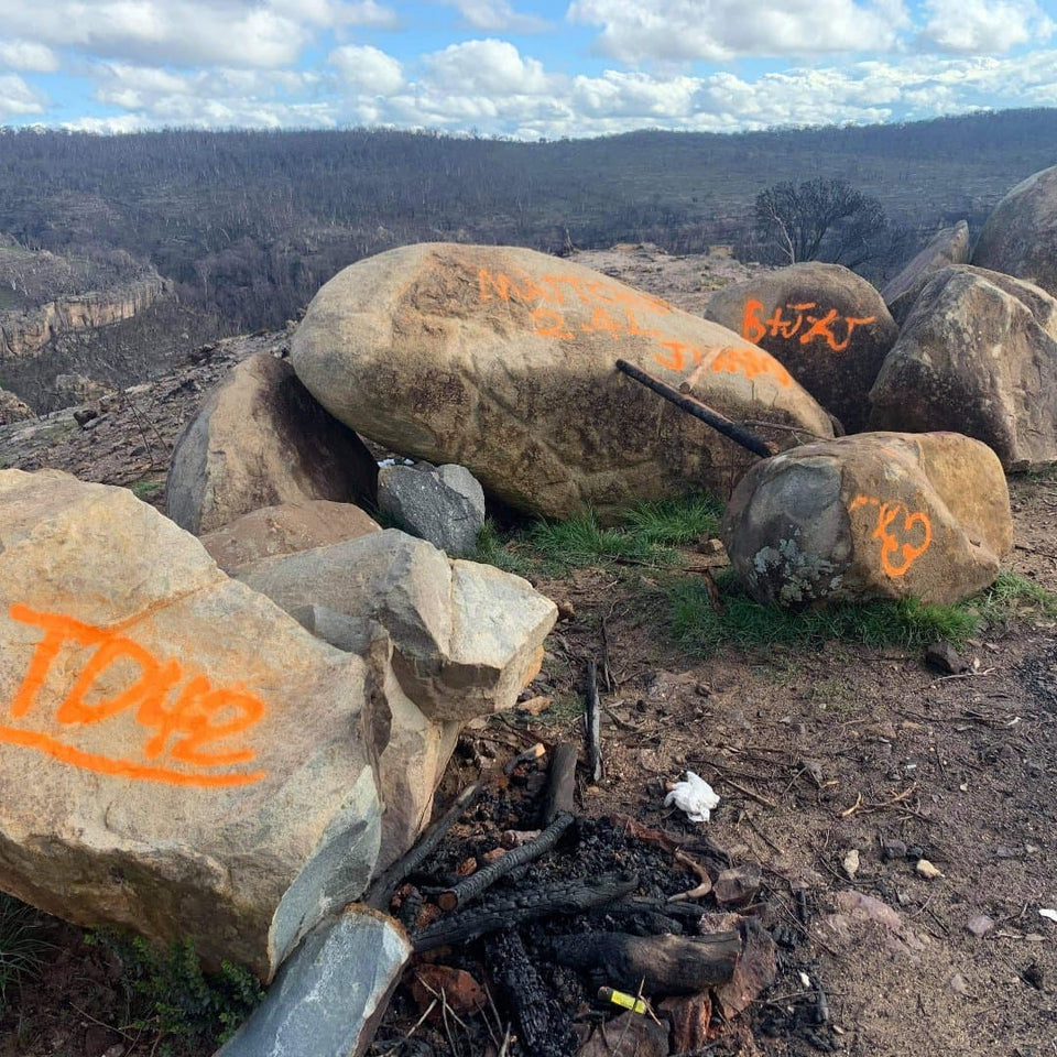
Thoughtless people
CWF 4WD Club gave up a lazy Sunday at home with the kids to clean up mess left by others. It's important to do this quickly because if left, others with add their "tags" to it.

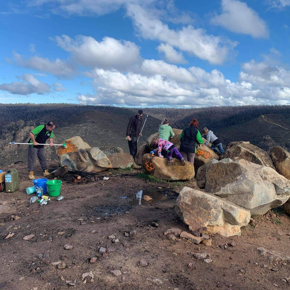
Hard workers
Club members brought rags, brushes, buckets and carted up the water to clean the orange paint left behind by selfish people. Our clubs promote "leave nothing behind" philosophy.

Natural beauty restored
Doing this teaches our children to be better than the people that left the orange paint. The Lost City is a beautiful area on the Newnes Plateau that is there for us all to enjoy.
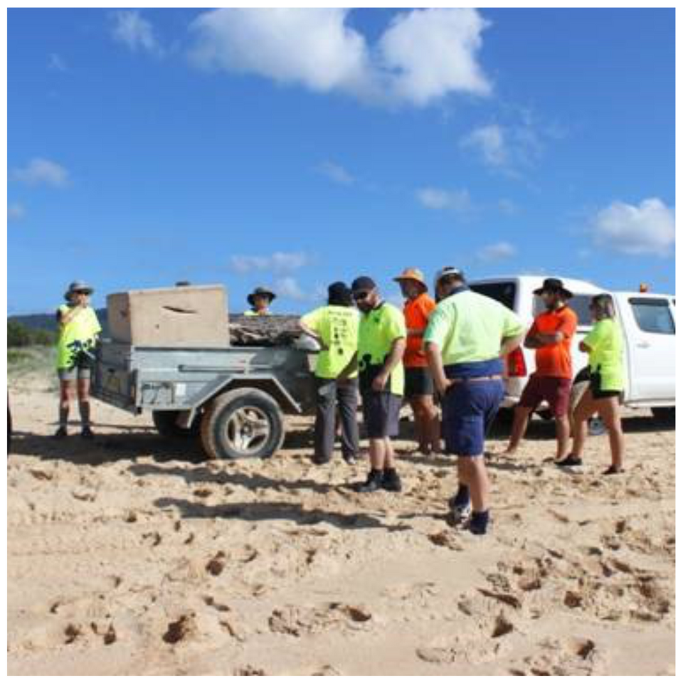
Clean Up of Towradgi & Fairy Meadow Beaches by Southern Region Clubs

Clubs working together
On March 1st, Clean Up Australia Day, the Black Diamond Recreational 4wd Club Inc and the Illawarra Suzuki 4wd Club joined forces to clean up Towradgi Beach and Fairy Meadow Beach through to Puckeys Reserve Wollongong.

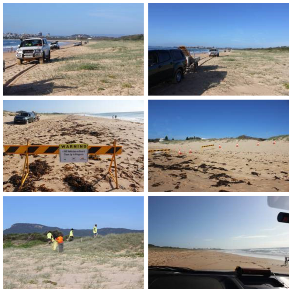
Leave nothing but footprints
The two clubs were granted special permission to drive the beaches for the registered Clean Up Australia Day Event. A long day in the sun cleaning up two beaches with 10 vehicles and 17 people signed up to help.

Safety talk
Rubbish collected consisted of the usual bottles and plastics but they also came across 4 lounge chairs dumped up high in the dunes that they removed. Once again these beautiful beaches are safe and rubbish free.
Clean Up - Olney and Wyong State Forests

3 clubs got together
One large group headed off to an area of Wyong State Forest along with large trailers and the Forest Corp truck while the two other groups headed off to Curtis Road and Tobins Road with their trailers. It is amazing the amount and type of rubbish people dispose of in the bush. Everything from bike frames, tyres, kid's toys, building materials, car parts, clothes and a large plastic swimming pool among other things were extracted and taken to the tip.

A traditional sausage sizzle
By lunch time workers and loads of rubbish began to trickle in to the BBQ area.
The superbly prepared sausage sandwiches were gratefully demolished and the cold soft drinks and water hit the spot. A silent auction which raised $50 for Camp Quality was held for a 2.3 litre pail of honey donated by a local beekeeper who turned up and praised our efforts.

Some facts and figures:
45 people, including 5 kids, 8 trailers, 1 truck, removed 6.2 tonnes of rubbish including approximately 100 tyres from the bush.
3 Four Wheel drive Clubs attended: Forest Corporation provided a truck and driver. The Report Illegal Dumping Squad sent two investigators. Well Done Everyone!
Chichester SF - Telegherry camp ground rehabilitation

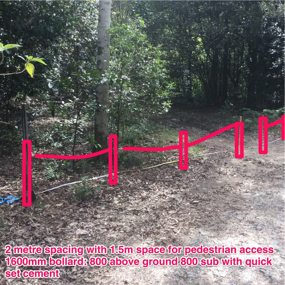
What needed to be achieved
The Telegherry Camp Ground within the Chichester State Forest had sustained significant damage through an inconsiderate act of vandalism from irresponsible people on a recent weekend of destruction at the Telegherry Camp Ground during a wet weather event.

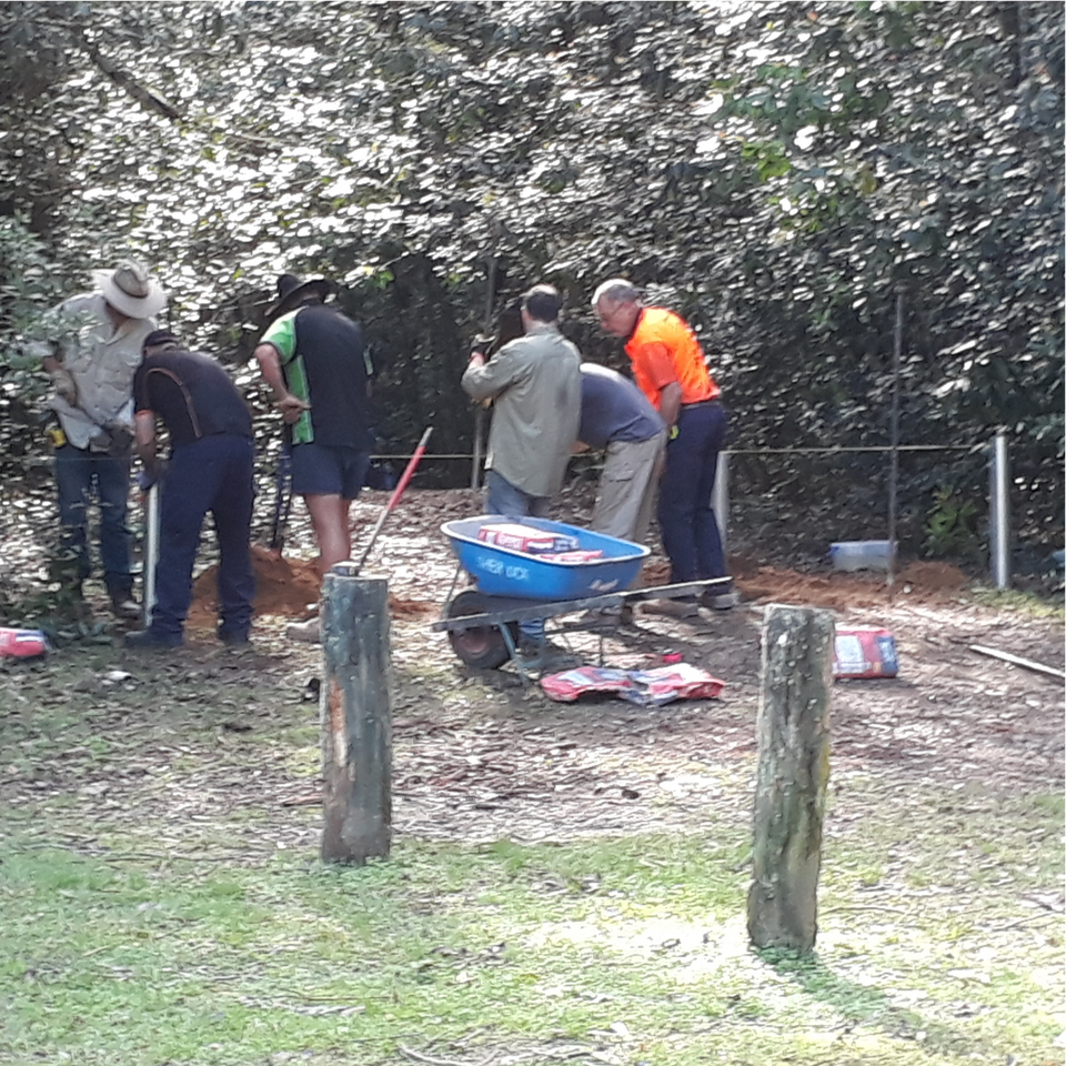
Getting the work done
After lunch, concreting the bollards took place and the continuation of flattening out the campground using a vehicle doing reverse circle work slowly towing around a makeshift leveller to flatten out the wheel ruts then spread the grass seed as evenly as possible.

The work crew
Clubs from 3 regions responded to the call. Port Hunter 4wd, Black Diamond 4wd, Triple Diamond 4wd, Era Recreational, Crossed Up 4wd, and CWF 4wd.
There was also a local resident, Jamieson Reading who wanted to assist in the rehabilitation of the area.
Homestead Restoration by Grafton & Districts 4wd Club

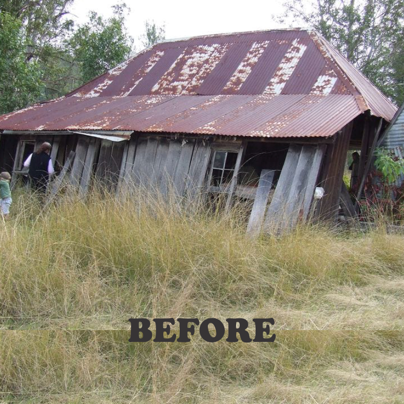
Cunglebung Homestead
Maintenance Day - March 31st 2019
The homestead was established around the 1850's, one of the first routes from Glen Innes to Grafton.
The Grafton & Districts 4wd Club has been working with National Parks and Wildlife Services for over 15 years to get this piece of Clarence Valley history to where it is today. Another cracker of a day to attend to Cunglebung Homestead.

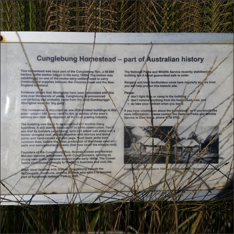
Circa 1850
Twice a year club members attend to mowing, whipper snipping and tidying up around this homestead.
The Club has most members registered as NPW&S Volunteers, they give freely of their time and equipment to perform this task, this is also behind locked gates as are other huts that the club helps to maintain. The drought has gripped the area, many of the creeks & springs have run dry, the country is hurting.


After years of hardwork
These days are a great opportunity for our members to get out, especially after an extreme fire season that has prevented the club from traveling many of tracks and trails that we like to frequent.
Written by Jon Kenny, President of Grafton & District 4wd Club.
Thank you to the members of the Grafton & Districts 4wd Club for your time and your effort.
Training Courses on the Events Calendar
Training courses can be found on the calendar. Click Here to Keep Up To Date
Delegates are invited to attend our upcoming meetings. Watch the newsletters for details.
RSVP to office@4wdnow.com
Apologies to secretary@4wdnow.com
See Members Only section for previous minutes, financials and agenda.
May 18 2024 Quarterly + COCO - Mudgee Showground at 9am
Aug 17 2024 Quarterly - Wangi RSL Club. 275 Watkins Rd, Wangi Wangi NSW at 10am
Nov 16 2024 Quarterly + AGM - Asquith Bowling Club. 1 Lodge Street, Hornsby NSW at 10am
Feb 15 2025 Quarterly - TBA
Platinum partners
"taking the family into the bush - there's true value in that"
- Robin, Aboriginal Elder, Coffs Harbour June 2019.